LiDAR is a technology that seems to become more widely used each day. Primarily a technology used for surveying, LiDAR has become a crucial process for businesses and applications that rely on geospatial data.
And whether you’ve come across this type of laser scanning technology before or not, it’s starting to make its way into our everyday lives.
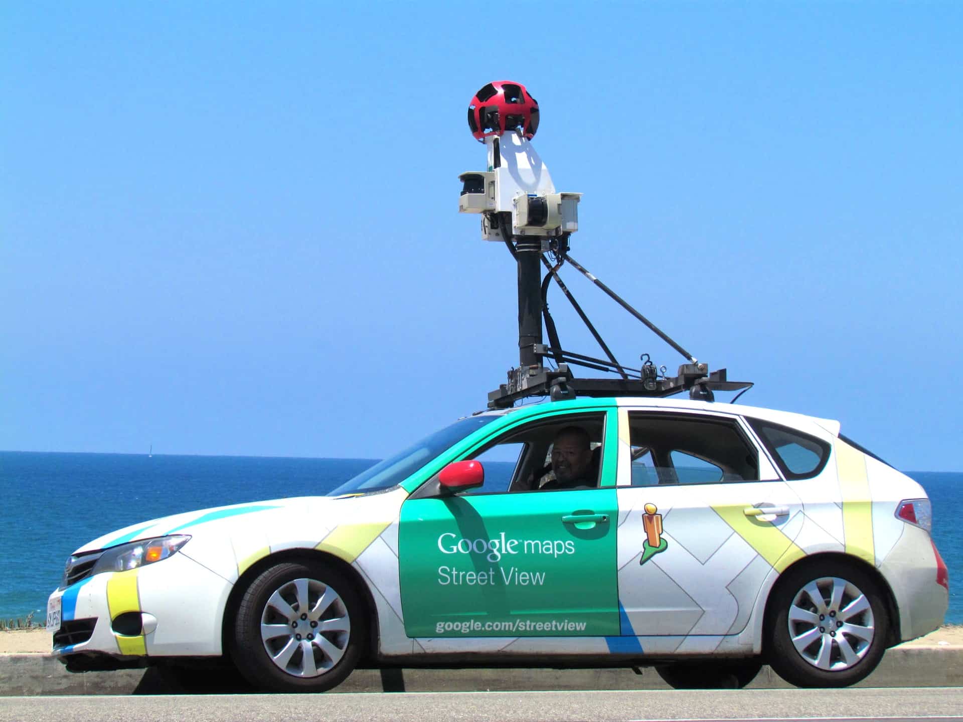
IMAGE: UNSPLASH
What Is LiDAR?
If you’re not familiar with LiDAR, or light detection and ranging, it’s a type of laser scanning technology that collects information from surfaces with laser pulses.
LiDAR systems project thousands of laser pulses per second that all bounce back to the sensor after reflecting off of surfaces (the ground, a building, or object). The distance traveled by each laser pulse, and the time taken for laser pulses to complete this journey is measured and used to calculate points, also known as XYZ coordinate.
Each laser projected by the sensor will return an XYZ coordinate, and by the end of a scan, millions of these points will have been collected, collectively forming point cloud data. Point clouds form a complete digital representation, or “digital twin,” of the area scanned with LiDAR systems.
How Is LiDAR Playing A Role In Our Everyday Lives?
As you can imagine, LiDAR’s ability to collect information from surfaces makes it the perfect surveying tool. However, LiDAR systems are adapted to suit different applications. You can find large LiDAR systems that can scan thousands of feet, or tiny systems small enough to be built into everyday devices — some even small enough to fit on your fingertip!
With LiDAR suitable for a range of applications and budgets, this technology is used in commercial and consumer markets. In some instances, LiDAR is also improving our day to day lives.
iPads, Augmented Reality And Laser Scanners
In March 2020, Apple announced a range of features that we can expect to see in the new iPad Pro. This was big news for the LiDAR market.
As you’d expect, the update to this popular device included a new bionic chip and improved camera capabilities. But one new addition most of us weren’t expecting was the introduction of a built-in LiDAR scanner.
Apple announced the LiDAR scanner would work alongside the device’s cameras and motion sensors to sense depth and measure the distance of objects and surfaces up to five meters away. The potential of the new iPad’s depth-sensing capabilities can be fully explored with different apps. For example, the new LiDAR scanners improve the accuracy of measuring apps and allow you to calculate the height of a person or an object’s dimensions.
By giving iPads an improved “understanding” of a scene through depth-sensing, the LiDAR scanners also open up a whole world of possibilities in terms of augmented reality. Certain apps make it possible to browse furniture online and using the iPad’s camera and LiDAR scanners, see how furniture will look in your home. If you want to take your interior designing one step further, some apps can use the LiDAR scanner’s measuring capabilities to measure whole rooms and create 2D floor plans or 3D models.
Augmented reality using LiDAR can also keep little ones entertained by transforming ordinary scenes into exciting fantastical worlds. AR apps allow you to look through the iPad screen and see fun characters pop up in your home, in the garden, or wherever you point the camera. You can also change the appearance of scenes — for example, in the words of Apple, you can “transform your living room into a lava-filled obstacle course.”
Getting From A To B With The Help Of LiDAR
Let’s be honest; most of us won’t attempt to walk or drive a new route without the help of route-planning applications such as Apple Maps and Google Maps. LiDAR plays an instrumental role in making sure these apps are accurate and effective in giving directions.
During laser scanning surveys, data from roads, railways, sidewalks, and footpaths can be gathered quickly and used to map road networks and pathways. The speed and accuracy of LiDAR scans make it possible to gather complete datasets from all areas, so accurate directions can be given to just about any destination.
Google and Apple Maps both use a combination of mobile LiDAR scanners, cameras, and GPS systems mounted on vehicles, which you’ve probably seen around before. These systems can collect data as they drive — there’s no need for the vehicles to stop to scan.
These LiDAR systems and cameras scan in all directions, so the resulting data represents not just roads and sidewalks, but also any surrounding buildings, structures, vegetation, and objects like street lamps, fire hydrants, road signs, and guard rails. These complete datasets can bring the scanned areas to life in the form of panoramic street views.
Making Your Journeys as Safe as Possible
How many times would you say you travel by car or train? Or walk along a sidewalk? For most of us, the answer is at least a couple of times a day. But regardless of how many times you do one of these things, you probably don’t think about the steps taken to minimize any health and safety risks that you and other drivers, passengers, or pedestrians might face.
Many transport agencies and local authorities use LiDAR to gather information from roads, railways, and footpaths. The speed and efficiency of LiDAR for land surveying means health and safety risks can be identified, located, and resolved as quickly as possible.
For example, a LiDAR survey might draw attention to vegetation or structures that encroach onto routes, weakened retaining walls, clearances that are too narrow or low for certain vehicles, and gradients that don’t meet surface gradient requirements.
The safety of road layouts can also be tested using LiDAR surveys and the resulting data. When data is processed with point cloud processing software, traffic flow, collision risks, and speed limits can be assessed and analyzed using semi-automated tools and vehicle simulation. Data is represented in the form of a 3D digital model. A virtual vehicle can be moved through the model to check the safety of roads or railways and identify any collision risks.
Thanks to LiDAR’s ability to capture even small details, it can shed light on the condition of surfaces and identify potholes, uneven ground, and other safety risks on sidewalks, roads, and railroads.
If you are interested in even more technology-related articles and information from us here at Bit Rebels, then we have a lot to choose from.

COMMENTS